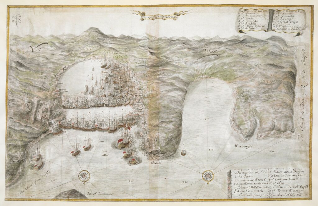
George III av Storbritannia hadde en stor kartsamling, og denne blir for tiden publisert på nett av the British Library. I tillegg til et par kart over Norge (1, 2), er det også et flott kart over Bergen fra august 1665, som skal vise Bergen under angrep fra den engelske flåte:

Litt mer info fra British Library:
Map of Bergen, during the attack upon the town by the English fleet, numerous ships-of-the-line blockading the harbour, the buildings and fortifications of the town on the shores, hills and mountains beyond. […]
Titled «Bergen in Norway;» being a colored bird’s-eye view, on vellum, of the attack upon the town by the English fleet, «described from the life, in Aug. 1665, by C.H.,» with «the names of His Majestie’s shipps of Warre» in the Catalogue of Maps, Prints, Drawings, etc., forming the geographical and topographical collection attached to the Library of his late Majesty King George the third, etc., London, 1829.
